Punakaiki
Destino de férias na natureza

Fotos de: Punakaiki
Mapa de localização
Aeroportos
Hotéis e outros Alojamentos
World Nomads
O Seguro de viagem com as maiores coberturas

O Seguro de viagem com as maiores coberturas
Punakaiki
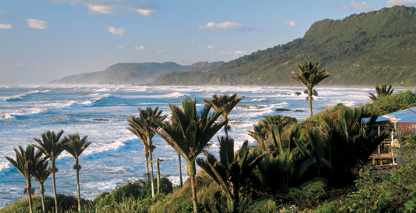
Punakaiki é uma pequena comunidade na costa oeste da Ilha do Sul da Nova Zelândia, entre Westport e Greymouth. A comunidade fica à beira do Parque Nacional Paparoa.
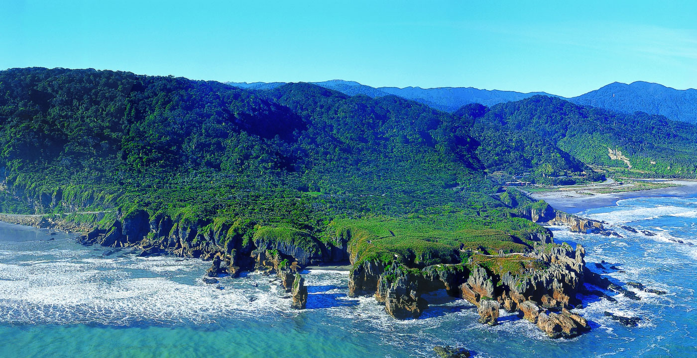
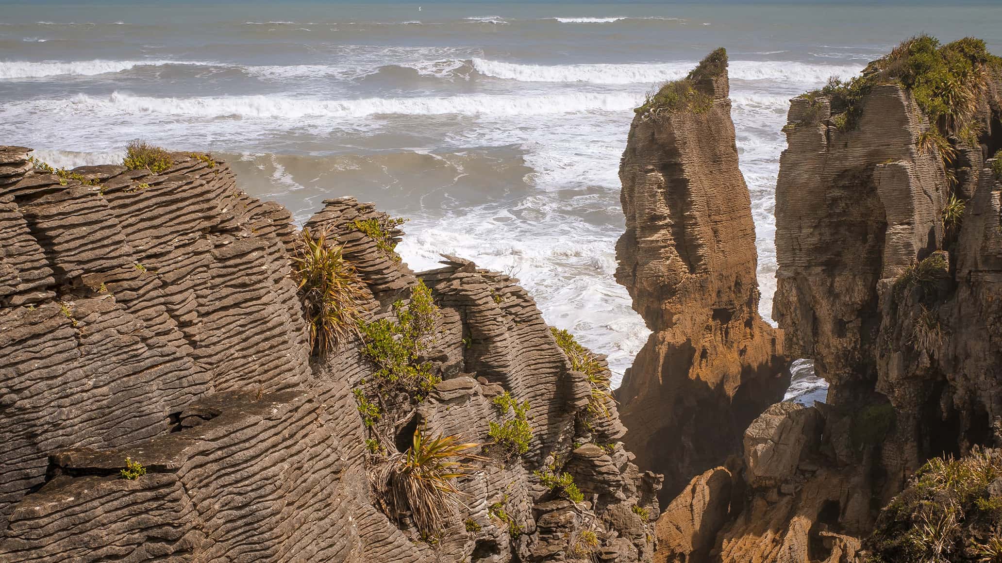
As Pancake Rocks são um objetivo turístico muito popular no ponto de dolomite ao sul da vila principal. As Pancake Rocks são uma área de calcário fortemente erodida, onde o mar explode através de vários buracos verticais durante as marés altas. Juntamente com as camadas de "panquecas" do calcário (criadas pela imensa pressão sobre a alternância de camadas duras e moles de criaturas marinhas e sedimentos de plantas), estas formam a principal atração da área.
As Pancake Rocks são atualmente exploráveis por uma série de passagens que serpenteiam através das formações rochosas, partes destas acessíveis a cadeiras de rodas e outras esculpidas em escadas para cima e para baixo nas paredes rochosas.
State Highway 6, a única estrada através da costa oeste, passa pela cidade.
Turismo
Deslumbre-se com as rochas empilhadas como panqueca e as crateras de Punakaiki, onde colunas de água jorram para o céu saindo de rochas que lembram pilhas gigantes de pão quente.
A natureza começou a sua obra de arte há cerca de 30 milhões de anos. Por milhares de anos, camadas estratificadas de pequenas criaturas marinhas e de areia foram enterradas e comprimidas no leito do oceano. Esse processo criou áreas com múltiplas camadas de calcário resistente e arenito mais macio. A atividade sísmica então elevou o leito oceânico para a superfície, e aqueles artísticos movimentos lentos, a chuva e o vento, começaram a desgastar o arenito mais macio. Esse trabalho resultou em penhascos e ravinas com centenas de fatias horizontais ao longo das faces verticais, como enormes pilhas de panquecas.
Em muitos lugares dentro dos penhascos, poços de ar estreitos na vertical criados pela chuva se encontraram com túneis horizontais criados pelo oceano batendo forte em suas paredes. Atualmente, durante a maré alta, as ondas do oceano avançam pelos túneis cada vez mais estreitos e empurram grandes volumes de água e ar comprimido para cima através dos poços verticais. O resultado é uma paisagem sibilante e palpitante que ritmicamente lança colunas de água salgada como os gêiseres. É uma visão impressionante.
A trilha proporciona vistas magníficas das montanhas do continente, do litoral acidentado e da principal atração, as rochas empilhadas como panquecas e respiradouros. Uma sinalização informativa ao longo do caminho o ajuda a entender o que estiver vendo. O melhor momento para visita é durante a maré alta.
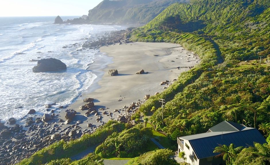
O pequeno povoado da costa oeste de Punakaiki serve de anfitrião para visitantes que vêm para observar as famosas rochas empilhadas como panquecas e os respiradouros. Aqui encontrará algumas opções de acomodação, de albergues e casas de família a casas de campo independentes; há também uma variedade de locais para se comer e galerias. As operadoras locais oferecem passeios a cavalo, aluguer de canoas, exploração de cavernas, caminhadas guiadas e aventuras de rafting.
A natureza começou a sua obra de arte há cerca de 30 milhões de anos. Por milhares de anos, camadas estratificadas de pequenas criaturas marinhas e de areia foram enterradas e comprimidas no leito do oceano. Esse processo criou áreas com múltiplas camadas de calcário resistente e arenito mais macio. A atividade sísmica então elevou o leito oceânico para a superfície, e aqueles artísticos movimentos lentos, a chuva e o vento, começaram a desgastar o arenito mais macio. Esse trabalho resultou em penhascos e ravinas com centenas de fatias horizontais ao longo das faces verticais, como enormes pilhas de panquecas.
Em muitos lugares dentro dos penhascos, poços de ar estreitos na vertical criados pela chuva se encontraram com túneis horizontais criados pelo oceano batendo forte em suas paredes. Atualmente, durante a maré alta, as ondas do oceano avançam pelos túneis cada vez mais estreitos e empurram grandes volumes de água e ar comprimido para cima através dos poços verticais. O resultado é uma paisagem sibilante e palpitante que ritmicamente lança colunas de água salgada como os gêiseres. É uma visão impressionante.
A trilha proporciona vistas magníficas das montanhas do continente, do litoral acidentado e da principal atração, as rochas empilhadas como panquecas e respiradouros. Uma sinalização informativa ao longo do caminho o ajuda a entender o que estiver vendo. O melhor momento para visita é durante a maré alta.
O pequeno povoado da costa oeste de Punakaiki serve de anfitrião para visitantes que vêm para observar as famosas rochas empilhadas como panquecas e os respiradouros. Aqui encontrará algumas opções de acomodação, de albergues e casas de família a casas de campo independentes; há também uma variedade de locais para se comer e galerias. As operadoras locais oferecem passeios a cavalo, aluguer de canoas, exploração de cavernas, caminhadas guiadas e aventuras de rafting.
Clima
Com uma alta precipitação, o clima é um tema regular de conversação na Costa Oeste. Perto da costa a precipitação anual é de 2.000 a 3.000 milímetros e aumenta rapidamente para mais perto das montanhas. A maior precipitação, mais de 10.000 milímetros por ano, ocorre em uma zona estreita no lado oeste dos Alpes do Sul, acima de 1.200 metros de altura.
A inundação é uma ameaça sempre presente. Uma parte substancial do orçamento do Conselho Regional da Costa Oeste é gasto na construção e manutenção de bancadas ao longo dos principais rios e no monitoramento dos níveis dos rios e das chuvas.
Embora a precipitação seja alta em comparação com o resto da Nova Zelândia, geralmente ocorre em chuvas de alta intensidade. Nas principais cidades, perto da costa, mais da metade dos dias de cada ano são finas e sem chuva. Média anual de horas de sol entre 1.800 e 1.900 - menos do que em Christchurch, mas mais do que em Timaru.
Outros destinos turísticos em:
Nova Zelândia
Nova Zelândia
Outros destinos turísticos mundiais
Porquê reservar com ROTAS TURISTICAS
Os melhores preços
As nossas parcerias com os maiores operadores mundiais, oferecem uma pesquisa dos melhores preços de mercado.
Mais opções
No Rotas Turísticas pode reservar o hotel, comprar a passagem aérea, reservar o transfer do aeroporto para o hotel e vice-versa, reservar as excursões locais, alugar o carro, fazer o seguro de viagem e consultar os locais a visitar e onde ir
Dicas & Destinos de férias
Centenas de destinos de férias com todas as opções que lhe permitem facilmente escolher o destino que melhor combina com as suas férias de sonho.
ROTAS TURISTICAS
Links
Siga-nos nas redes sociais


